Electronic charts
Wärtsilä Pilot PRO

Revolutionize pilot operations – be a marine professional

Contact us

Wärtsilä Pilot PRO

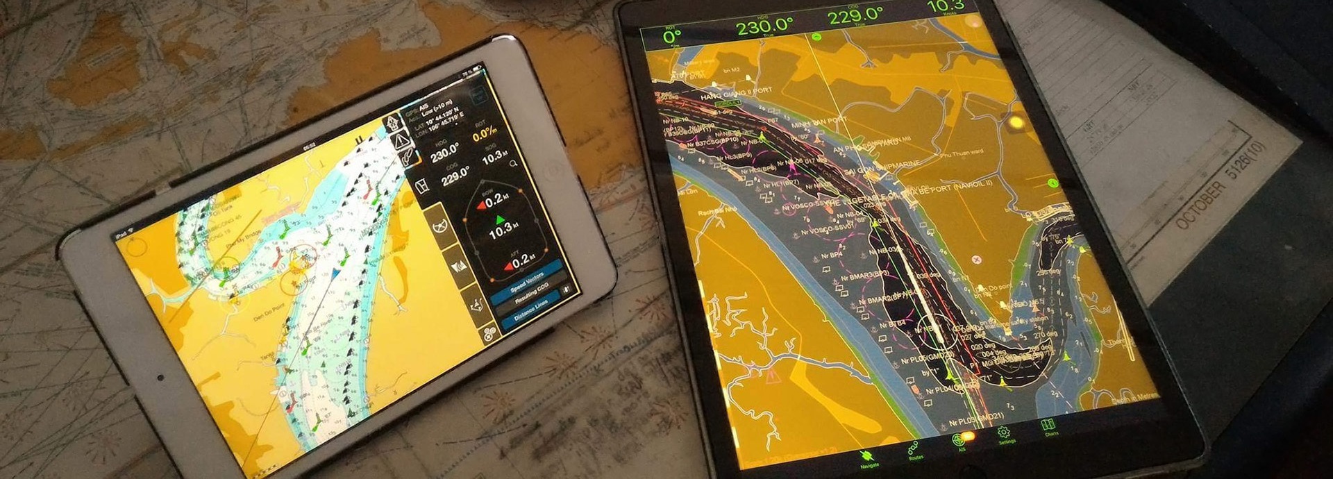
The Pilot PRO application has been developed specifically to meet the needs of pilot organisations and marine professionals. With a carefully considered range of support functions, the system is designed to assist pilots and navigation officers in their everyday activities. By bringing mobility and freedom on the bridge, it helps pilots to maintain efficient pilotage and other onboard operations. The app is fully customisable, as data can be integrated from different sources. To facilitate navigation under local pilotage conditions, Pilot PRO supports local navigational information, such as tidal currents, tidal reference points (high & low water, graphical diagram) and weather forecast data (wind, wave, air pressure, precipitation).

All necessary tools in one application

  • Navigational warnings and alarms
  • Docking mode
  • Ship maneuvering predictor
  • Fender lines and auto distances
  • AIS target meeting points and rendezvous points (RDV) on a selected route
  • Navigational data exchange via standard connection types to additional or onboard equipment (AIS transponder and others), secured data feed from VTS, etc.

Key features

  • Intended for navigation, docking and mooring operations
  • Multi-language support
  • Supports interfacing to AIS pilot plug and independent PPU sensors
  • S-63, S-57 and TX-97 ENCs and updates
  • Virtual boarding, advanced data logging and playback for situation awareness and training capabilities
  • Ready for e-Nav integration with VTS and pilot management systems
Electronic chart on tablet

See how it works

Additional information

Specific Features

  • Docking and Conning modes 
  • Ship Maneuvering Predictor
  • Fender Lines and Auto Distances
  • Waypoints along a route for AIS Targets
  • Tides and Currents
  • Meteorological and Nautical data
  • Regularly Updated Vector Electronic Navigational Charts
  • Connection to additional sensors, various devices and infrastructures

Personal Pilot Unit (PPU)

  • Docking mode: operational and hidden modes
  • Ownership predictor: by ship contours or outline
  • Conning display for mooring operations
  • Speed vectors: resulting COG or Fore’n’Aft speed vectors
  • Fender Lines: Auto distances to fender lines, AIS and chart objects
  • AIS Targets: meeting points and rendezvous points
  • Chart 'Info' functionality & various display palette modes (Day, Dusk and Night)

Nautical Charts

AVCS S-63 & S-57 ENC and TX-97 Vector Chart formats with Updates services


Official Electronic Navigational Charts (ENCs) collection (S-63 & S-57 formats)


Electronic Navigational Charts (ENCs) collection (TX-97 format)

Multi-Connection to various sensors & data sources

Pilot PRO supports a complete set of pilot sensors. The connection to external sensors can be performed via:

  • AIS Wi-Fi Pilot Plug device to the AIS Transponder Class A
  • Wi-Fi interface to external independent sensors: NMEA GPS, ROT & HDG Sensors 
  • For backup positioning purposes you can use built-in iPad GPS/GNSS receiver (for iPad “Wi-Fi + Cellular” models with 3G/LTE/Cellular), and/or external Bluetooth GPS/GNSS receiver (for all iPad models)

Wärtsilä Marine. Let's connect.